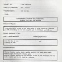
Reports : Reclassification of Road Used as a Public Path Nos. 158 & 159 Marple : 1995
Dublin Core
Title
Reports : Reclassification of Road Used as a Public Path Nos. 158 & 159 Marple : 1995
Description
Two original copies of Reports of the Chief Executive from Committees : Marple Area Committee & Technical Services Sub Committee, to gain authorisation to make an order
(a) to reclassify the road used as a public path No. 158 as a bridleway. This runs from the Derbyshire County boundary west of Strines station generally in a north-westerly direction to Bridleway No. 118 Marple
(b) to reclassify the road used as a public path No. 159 as a bridleway. This runs from RUPP No. 158 Marple to the junction of Bridleway No. 153 Marple and Footpath No. 155 Marple.
Both reports contain maps of the local area mentioned in the report.
Date
Reviewed AB 09/2023
Identifier
UDC/01/010
Louiset
Louiset
Collection
Citation
“Reports : Reclassification of Road Used as a Public Path Nos. 158 & 159 Marple : 1995,” Marple Local History Society Archives, accessed December 22, 2024, https://mlhs.org.uk/archives/items/show/1827.
