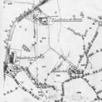
Two Maps : Location of Windlehurst Hall : 1872-5 & 1980
Dublin Core
Title
Two Maps : Location of Windlehurst Hall : 1872-5 & 1980
Description
Two photocopies of Ordnance Survey Maps showing location of Windlehurst Hall in Marple:
1. OS XX10 25" : 1872-5 showing Windlehurst House with Gasometer, Windlehurst Cotton Mill, Lumberhey and Andrew Farm.
2. OS SJ88/98 1:25000 : 1980 highlighting Windlehurst Hall.
1. OS XX10 25" : 1872-5 showing Windlehurst House with Gasometer, Windlehurst Cotton Mill, Lumberhey and Andrew Farm.
2. OS SJ88/98 1:25000 : 1980 highlighting Windlehurst Hall.
Date
Reviewed AB 07/2023
Identifier
WIR/01/01
Louiset
Louiset
Collection
Citation
“Two Maps : Location of Windlehurst Hall : 1872-5 & 1980,” Marple Local History Society Archives, accessed December 22, 2024, https://mlhs.org.uk/archives/items/show/1921.
