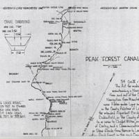
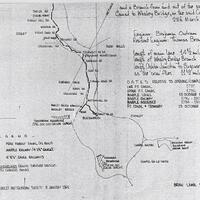
Peak Forest Canal Hand drawn Map : 1967
Dublin Core
Title
Peak Forest Canal Hand drawn Map : 1967
Description
Photocopy of hand drawn technical map by Brian Lamb, Stretford dated 1967 with dimensions, and history with important dates on A3 paper.
Date
Reviewed AB 09/2022
Identifier
CAN/04/013
Louiset
Louiset
Collection
Citation
“Peak Forest Canal Hand drawn Map : 1967,” Marple Local History Society Archives, accessed December 22, 2024, https://mlhs.org.uk/archives/items/show/1974.

