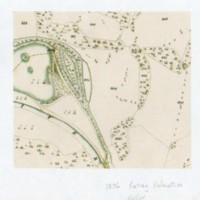
Several Maps relating to Roman Lakes Area: Various dates
Dublin Core
Title
Several Maps relating to Roman Lakes Area: Various dates
Description
Six photocopies of maps covering the area of the Roman Lakes :
1836 Rating Valuation, Mellor Map
1849 Tithe Map (Section) Shows old Hall, Lake, Windybottom
4 Downloaded maps from Cheshire Archives & Local Study website : 3 showing sections of the 1836 - 51 tithe map with one untitled showing larger area.
1836 Rating Valuation, Mellor Map
1849 Tithe Map (Section) Shows old Hall, Lake, Windybottom
4 Downloaded maps from Cheshire Archives & Local Study website : 3 showing sections of the 1836 - 51 tithe map with one untitled showing larger area.
Identifier
CAB/03/06/07
Louiset
Louiset
Citation
“Several Maps relating to Roman Lakes Area: Various dates,” Marple Local History Society Archives, accessed May 9, 2024, https://mlhs.org.uk/archives/items/show/2258.
