House Clearance Area : Marple U D C Drawings and Schedules : 1950's
Dublin Core
Title
House Clearance Area : Marple U D C Drawings and Schedules : 1950's
Description
Several photocopies of maps, schedules and material relating to the housing clearance during the 1950/60's : All on A3
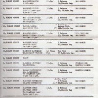
a. Two page Typed schedule dated 1961 listing properties addresses, with information on the Tenants and families, their requirements when their properties are demolished.
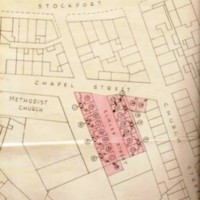
b. Two original MUDC maps showing clearance area including Elmley Street, Chapelfields and Poplar Square. No date.
c. Photocopies on A3 paper of MUDC maps and additional information on the houses for clearance including the following streets :
Area 1 : Joseph Street : 4 Houses
Area 3 : Stone Cottages, Cross Lane : 7 Cottages and other buildings
Area 4 : Stone Row 37 Houses and other buildings
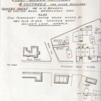
Area 5 : Jolly Sailor Cottages : 8 Cottages and other buildings
Area 6 : Ring o' Bells cottages : 3 Cottages and other buildings
c. Drawing of houses with dimensions and tenants showing outside toilets and surround buildings No name.
Creator
Marple Urban District Council : Public Health Inspector : F Shacklock
Source
Peter Clark
Date
Reviewed AB 10/2022
Identifier
HOU/03/012
Louiset
Louiset
Collection
Citation
Marple Urban District Council : Public Health Inspector : F Shacklock , “House Clearance Area : Marple U D C Drawings and Schedules : 1950's,” Marple Local History Society Archives, accessed December 22, 2024, https://mlhs.org.uk/archives/items/show/2328.


