Material on Collieries in Marple/Mellor Area : R Thackery
Dublin Core
Title
Material on Collieries in Marple/Mellor Area : R Thackery
Description
Material on Collieries in Marple / Mellor Area : Collected by Rod Thackery : Donated 2022
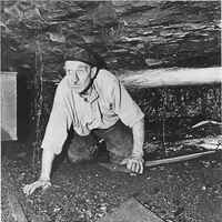
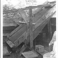
Selection of black and white and colour photographs from Ludworth Coal Mine
Handwritten and typed Mine Leases : Ganister Mining : 1919
Two 6”O S Maps : 1898 showing mines in the Compstall, Chisworth, Ludworth and Mellor areas 1928 showing mines in the Compstall, Marple Bridge, New Mills area.
Nine Second Edition 1898 maps on A4 paper showing mines in Ludworth/Mellor Area
Coal Authority map 1 to 2500 : Parish of Chisworth : Plan of Chew Wood Colliery abandoned 30th June 1912
Coal Authority Maps of Mines : Holyhead Collery abandonment 1911 Barlow Wood 1925, Bottoms Collery Mountain Mine, Ludworth Moor Colliery and Peacock Pit.
3 Page extract from pittdixon website on Upper Peak Forest Canal identifying two coal mines near Brick Bridge.
2024 : Further material received on Coal Mines in the Marple & Surrounding Area this was passed to Marple LHS by Rod Thackray via Neil Mullineux. November 2024 :
1. Photocopy : Plan of Coal Edge Collery in New Mills dated 1932.
2. Photocopy : Plan on Abandonment on Barlow Wood Colliery in Marple 1983 – 1924.
3. Sketch of Section of Mountain Mine
4. Plan of Ernocroft Wood Pit coal works as in operation by George Andrew Esquire 1847
5. Dupty's Plan : Ludwortjh Moor Colliery, Compstall Two Feet Seam : Undated
6. Plan drawn by R Thackray 1990 of Dog Clough Ganister Mine around Ernocroft Lane.
7. Plan drawn by R Thackray 1998 of Lower Mountain Mine, Compstall.
8. Sketch of mine shaft workings by R B Thackray.
Identifier
COA/01/013
Louiset
Louiset
Collection
Citation
“Material on Collieries in Marple/Mellor Area : R Thackery,” Marple Local History Society Archives, accessed December 22, 2024, https://mlhs.org.uk/archives/items/show/2742.

