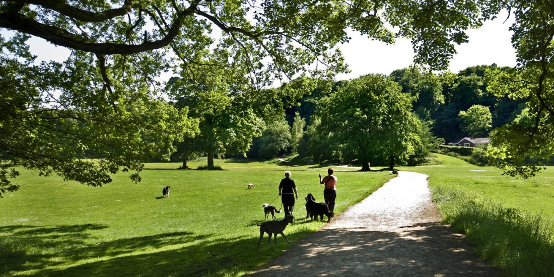
 Brabyns Park
Background
A generation ago, two enterprising teachers developed an Interest Trail for second year pupils at Marple Ridge High School. Mrs J Harker and Miss R L Niven (unfortunately we have no record of their first names) were trying to encourage an interest in the natural world and local history by creating a marked trail around Brabyns Park. 21 stopping places were identified and features of interest described, though it would appear that two of these stops were afterthoughts as the numbers go from 1 to 19 with extra points inserted as 14a and 17a. They obviously intended this to have a permanent appeal because 21 marker stones, each engraved with the appropriate number, were installed around the trail. These were quite substantial and attractive stones, rough cut in a rectangular shape, approximately 11 to 14 inches wide, six or seven inches deep and usually buried so that they had an apparent height of 15 to 18 inches.
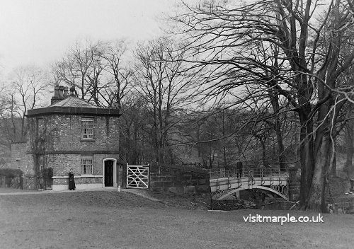
Brabyns Park Iron Bridge and Cottage c1890
In 2009 the Iron Bridge Restoration Project used this trail as a foundation for part of their own efforts to raise interest, not just in the Iron Bridge but in Brabyns Park as well. It was particularly aimed at children but there was plenty to interest adults as well. Regrettably there was no room for the attractive drawings produced as an integral part of the first leaflet but this was compensated by colour pictures for identifying birds and trees and flowers. Some of the observations made about the original trail were no longer apposite so descriptions were changed and some of the marker stones bypassed.
And now, in the spring of 2020, after much water has flowed along the Goyt, both of these trails are obsolete as nature has changed but the marker stones still survive. There is still much to see by following the trail in terms of both history and the natural environment but there is now an added interest; how many of the original marker stones are still in place? It says much for the workmanship of their original installation that so many are still there but some appear to have disappeared. Perhaps you can find ones that I have missed.
Point 1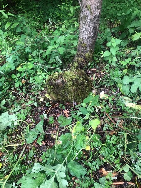
Start at the car park. You can join the trail at any point but the car park is a convenient place for those who have to travel to Brabyns Park. There should be a marker somewhere here but try as I might, I could not find it. Will you have better luck? You are looking for a stone marker, roughly 13 inches wide, 7 inches deep and up to 18 inches high.
Follow the road out of the car park leading into the park. After about fifty yards the road forks and you take the left fork. After another hundred yards you reach a Tee junction and turn left. This is where the detective work begins.
Marker 3
Point 3 Another view of Marker 3
The first marker you come to is well hidden at the base of a tree. This is number 3. (Don’t ask where number 2 is; you will find out in due course.)
Point 4 Photo of Marker 4-View1 and View2
A little further along you come to Marker 4 on the left hand side.
Point 5 Photo of Marker 5
The next marker is very close by, just before the bridge over the railway. It is Marker 5 and to prove it you can see ‘5’ inscribed on the face. Points 3 and 4 are well concealed by vegetation so there is no shame in missing them. However, if you are determined to find them retrace your steps from this marker. Point 4 is about 25 yards on the right and Point 3 is 90 yards, again on the right.
 Is this Marker 6 ?
Point 6 Photo of Marker 6
Cross over the railway bridge and go up the track towards the canal. Keep beside the retaining wall and don’t go up the steps to the towpath.
This is where you have to start looking hard. The description indicates that Marker 6 should be somewhere here but I can’t find it. The nearest item resembling it is this stone lying flat, about ten yards beyond the steps of the Seven Stiles path. Have you a better suggestion?
Point 7
Keep along the track, below the retaining wall and past the tennis club, to Station Road. Pause and admire the huge beech trees on both sides. This was the main carriage road to Brabyns Hall and the trees welcomed the owners home again.
The next marker, number 7, should be near Brabyns No 1 Lodge, the lodgekeeper’s cottage, but I could find no trace. Perhaps you will have better luck.
Point 8 Photo of Marker 8
When you reach the road, go a few paces uphill and turn onto the towpath. Marker 8 is between the two locks, 9 and 8.
Soon after Lock 8 there is a milestone with a distinctive curved top. This is an official Peak Forest Canal milestone, indicating a point 7.5 miles from Ashton. Because it is a half-mile marker it is somewhat smaller than the mile markers at Lock 15 (8 miles) and just below Bottom Lock House (7 miles.)
Points 9 & 10 Photo of Marker 9 & Marker 10
There are two markers near Lock Seven, Marker 9 and Marker 10. The former is to draw your attention to the mosses and lichens on the wall; the second is to suggest you investigate the small pond.
This pond was originally part of the reservoir for Lock 6 and the towpath went around it. However, it was deemed surplus to requirements so, to improve efficiency, the route of the towpath was straightened, cutting off the pond.
 Marker 12Point 11 Photo of Marker 11
Further down the towpath, between Locks 4 and 3 is Marker 11, placed there to draw attention to the stone fence posts which marked the boundary between the park and the canal land.
Continue down the towpath and, before reaching Bottom Lock Cottage take the footpath off to the right marked Midshires Way. Be careful here. The Midshires Way is a long distance footpath running from Stockport to the Chiltern Hills. If you are not careful you’ll end up in Buckinghamshire!
Point 12
Go down the steps and turn left at the bottom, where you will see Marker 12.
The path goes along the top of a steep slope. This is the old quarry which was used for building Brabyns House and the weir at Marker 17a.
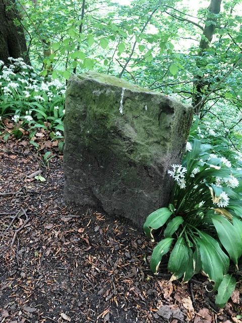
Point 13 Photo of Marker 13
Marker 13 is just before the bridge which goes over the main drainage ditch for Brabyns Park. It was initially placed here to draw attention to the Himalayan Balsam which, at the time, was a novelty. No longer, I’m afraid.
Point 14
After the bridge take the path to the left, forking left after about 50 yards, until you get to the river. Here should be Marker 14 but I couldn’t find it. Perhaps you will have better luck. What has also changed, but this time for the better, is the Goyt. The original guide talks about “the pollution that is obviously present in the river. There is an unpleasant smell and the brown-coloured water is covered with foam.” The past was not always idyllic.
Point 14a
Once you have found (or failed to find) Marker 14 you have another choice. You can take a detour to look for Marker 14a or you can carry on the usual route around the park perimeter. If you are adventurous you can see two remarkable pieces of engineering. The path downstream winds up and down and is certainly not wheelchair friendly but, if you are reasonably active it should pose no problem. Go along until you can see and admire both the viaduct and the aqueduct from a new perspective. While you are there please look for Marker 14a. I couldn’t find it but you might have better luck.
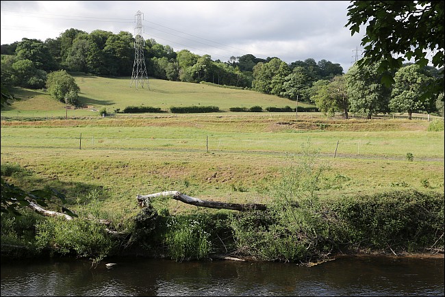
Back the way you came, then follow the path along the river. If you look on the other side you can see several river terraces, caused by the Goyt cutting down into its flood plain at various times since the Ice Age. There are matching terraces on the Brabyns side but they are not quite so obvious.
Point 15 Photo of Marker 15
Marker 15 is soon after you enter the small woodland, about 75 yards after passing the two old stone gateposts.. It is supposed to mark a wild cherry tree which is quite rare but I am no expert. I could only find the marker and not the tree.
Point 16 Photo of Marker 16
There was no difficulty finding the next marker. It was supposed to mark the confluence of the Etherow with the Goyt and, sure enough, it was there. You can even read the number quite clearly which is more than you can say for most of the others. In the original trail you were told to compare the clean waters of the Etherow with the polluted waters of the Goyt. Fortunately that is no longer possible.
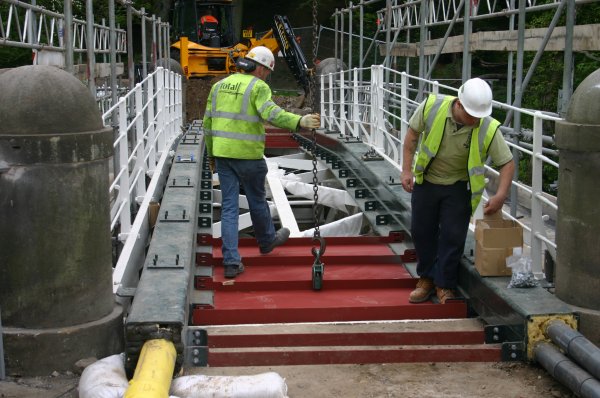 Iron Bridge Restoration
17 May 2008 - " Good progress - The deck plates were installed yesterday and repairs to the railings and pointing of the wing walls and abutments are nearing completion. A pristine bridge is now beginning to emerge from the scaffold as the restoration reaches another exciting phase."
Point 17
Carry on towards the Iron Bridge but there is an opportunity to view the Iron Bridge from the west side if you cut across to the river.
When you get to the Iron Bridge itself you have the opportunity of looking for Marker 17 as it should be there somewhere. Perhaps it got lost in all the renovation work.
However, it is well worth taking an opportunity to remind yourself about the enormous effort made by Mark Whittaker and Peter Clarke to raise interest in restoring the bridge and the organisations that were brought together to complete the task. This link to the Marple Website gives the fascinating story.
https://www.marple-uk.com/ironbridge/
Point 17a
Carry on along the river until you come to the substantial weir built by Nathaniel Wright who owned Brabyns from 1800 until his death in 1818.
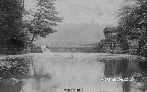
We could not find the marker in this area but we must correct the legend that has built up around the weir and which was endorsed by earlier descriptions of this trail. It is known locally as ‘Wright’s Folly’, the story being that he first built the weir but then realised that if he used it his own land would be flooded. This is obviously nonsense; an experienced mining engineer such as Wright would never have made such an elementary mistake. However, it is still ‘Wright’s Folly’ but for a different reason. He was trying to create the infrastructure for a factory which could then be sold at a substantial profit.
Unfortunately other landowners also had water rights and he was not able to bring his scheme to fruition and the weir remains a monument to his ill-judged ambition.
Point 18
Carry on along the river to another weir of somewhat later date. This was built in 1971 by the predecessor to the Environment Agency in order to measure the flow on the River Goyt. There should be another marker here but this person at least, was unable to find it. Can you?
Instead, you might give your attention to a rather more massive memorial stone, beside the path and well above the river. The story behind it and the achievement by a group of Marple volunteers in rescuing it from the river is described on the Marple Website.
https://www.marple-uk.com/stone.htm
Point 19 Photo of Marker 19
Continue along the path until you get to a long wall on the right hand side. This encloses what used to be the kitchen garden for Brabyns Hall but which is now used by the Parks Department. The Marker Stone is at the start of the wall, at the base of a bricked in doorway to the kitchen garden. There is an inscription on the lintel —MAH and the date but there is some dispute about the date. One trail guide gives it as 1903, the other as 1905. With such distinguished predecessors we are reluctant to venture an opinion. Suffice to say it is a reference to Maria Anne Hudson, the owner of Brabyns Hall at the time, who died in 1906 at the age of 87.
 Brabyns Stable mounting blocks
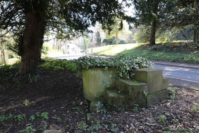
As you’ve reached Point 19 you probably think that you have reached the end of the trail. Well, not quite. Do you remember at the beginning we went from the car park straight to Point 3? Here at last, is the chance to see Point 2. But not before you visit two more interesting artefacts.
Follow the track alongside the kitchen garden until it opens out into an informal car park. Head towards Brabyns Brow but if you look back along the approach road to the car park there is a circular horse trough with combined mounting block amongst the trees on the right. This used to be outside the stables but was moved when they were demolished in the 1970s.
When you reach Brabyns Brow turn uphill and a few paces on you can get back into the park again. However, before you do, spare a glance for the millstone overlooking the road. The interpretation board tells its story but there is more detail as to how it got there on the Marple Website.
https://www.marple-uk.com/heritage/millstone.htm
Point 2 Photo of Marker 2
Back into the park and on your right is the dogs graveyard — twenty dogs of varying shapes and sizes plus one seagull. What had the seagull done to deserve this, I wonder? At the edge on the graves is Marker Stone 2. You have completed them all! Back to the car park for a well-deserved rest.
Read or download the walk guide here
For a map of the marking posts locations, click Map
Neil Mullineux - text and marker photos - June 2020
David Burridge - terrace photo and Brabyns mounting blocks
