No, this is not an article about the Local Heritage of our town’s namesake in Pennsylvania. Instead it uses Marple, Pennsylvania, as an example of a unit of local government that still survives today, more than a thousand years after it was first developed in order to separate civil authority from ecclesiastical authority.

The Battle of Hastings and the disruption of Anglo-Saxon control brought about many changes in the way this country was organised because the Normans had a very different philosophy. Under the Anglo-Saxons each ‘shire’ was divided into an unlimited number of ‘hundreds’. A hundred was ten groups of ten households and each household held one ‘hide’ of land. A hide was enough land to support one household so it could obviously vary considerably in size. Although Anglo-Saxon society was essentially feudal in character, the Norman system was much more severe - more centralised, more rigid and very thorough. The Anglo-Saxon ‘shire’ was retained though it was now called a county but all land was ‘held’ by the king and he had the right to dispose of it as he saw fit. He did this by awarding ‘fiefs’ to his followers and supporters but these were generally small and given out piecemeal so that no one had a large power base.
The hundreds were still recognised in the Domesday book but they gradually became more permanent administrative divisions rather than groups of households. Local administration was in the hands of the feudal lords who governed affairs in their fiefs. Almost all the population had been made into serfs who could not move freely so the basic social units became the parish, the manor or the township. Parish was an ecclesiastical division and was fairly consistent over time but the manors were the political fiefs and they changed control from time to time depending on the relative strengths of the lord and the national politics. So too with the townships which often conformed to ecclesiastical boundaries as divisions within a larger parish.
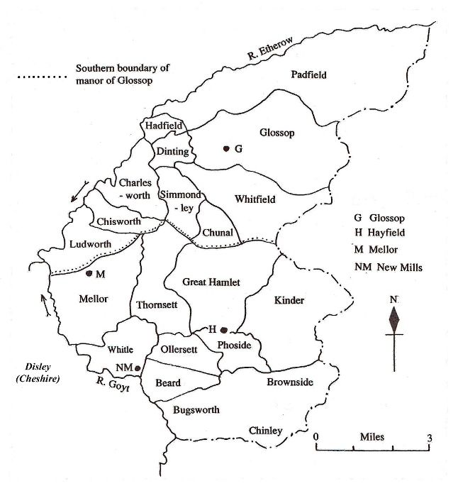
We can see this relationship between the parish and the more secular divisions in the parish of All Saints, Glossop.
Click map to see a more detailed map of the Hayfield chapelry.
The parish covers the whole coloured area. It is so large that two daughter chapels have been established at Mellor and Hayfield to serve the inhabitants except for important life events such as births, marriages and deaths. However, the manor of Glossop is much smaller than the parish, shown by the area in shades of yellow. Glossop was remarkably stable with unchanging boundaries because the manor was owned by Basingwerk Abbey until the dissolution of the monasteries in 1536. The parish of St Mary, Stockport shows a more varied picture as ownership and control of the manor and townships changed hands from time to time over the years through political change, marriages and alliances.
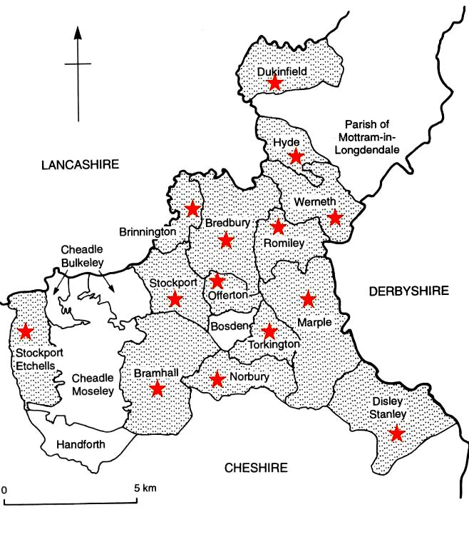
The shaded townships are all part of the manor of Stockport whilst the townships with red stars comprise the parish of All Saints, Stockport. In other words the parish of Stockport and the Manor of Stockport are identical at this point in time. However, Bosden in the centre of the Stockport townships is not included nor is Cheadle Moseley and Cheadle Bulkeley. These are part of a separate parish and separate manor.
Most of these changes in control and allegiance occurred between the twelfth and sixteenth centuries. Gradually, and over time, particularly as serfdom restrictions were relaxed, the power of local lords and local bishops declined and central authority increased. Townships were given more responsibility, albeit at a very low level at first. In the 1540s the office of lord-lieutenant was instituted in each county, effectively replacing feudal lords as the direct representative of the Crown in that county. At first the primary duty was military, raising and organising the county militia but this was added to by an increasing number of responsibilities. These in turn were passed on to the parishes and townships which were the most appropriate bodies to actually carry out activities such as maintenance of bridges, supervision of weights and measures and keeping basic law and order. From 1555 parishes were responsible for the upkeep of nearby roads and from 1605 they had responsibility for administering the Poor Law. Both of these tasks needed financing so they were given powers to raise money locally.
By the nineteenth century Britain was well through the change from an essentially rural society to an urban sophisticated community. There had been massive population growth, vastly increased urbanisation and the creation of an urban poor who had no mans of subsistence. The small-scale government apparatus that had evolved could not cope with these new circumstances. In 1837 laws were passed allowing rural parishes and townships group together as Poor Law Unions. In 1848 a Public Health Act authorised local boards to regulate sewage and the control of disease. In 1866 all land which was not part of ecclesiastical parishes was formed into civil parishes and there were further Public Health Acts in 1873 and 1875.
By 1888 it was clear that the piecemeal system that had developed over the previous century in response to the vastly increased need for local administration could no longer cope. The Local Government Act of 1888 brought about wholesale reorganisation by creating Administrative Counties, and County Boroughs at the first level but the counties then created Urban and Rural District Councils. The parishes and the townships were abolished after a thousand years.
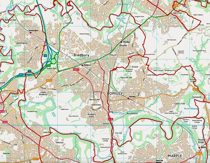
Or were they? Their responsibilities had been passed on but the communities remained and their boundaries and local loyalties still reflected the ancient townships. The old boundary of Marple Township has been superimposed on a modern map and few would dispute that the enclosed area is very much the Marple that we still think of. Similarly, a modern map showing the township boundaries of Bredbury and Romiley would be recognised by local councillors today. The concept of a township and even the boundaries of a township have proved remarkably resilient. They are still very recognisable almost 150 years after their disappearance in England.
Indeed, in other countries they are still very active. They survive as administrative units in Eastern Canada, in three areas of the USA and in India. These countries have all had a British influence which could explain the survival but the concept of a township is also used in China where it defines the fourth level of the administrative hierarchy. Perhaps the township is not dead or dying. Perhaps it is due for a come-back!
