In recent years the term ‘street furniture’ has become very familiar, indeed ubiquitous. At times there is so much of it that it gets in the way or, at the very least, presents a distraction. However, there have been various forms of street furniture for centuries and although the forms and materials might evolve, they serve the same functions as always - showing direction, giving guidance, marking distance, delimiting boundaries. Although many signs and markers have disappeared or have been superseded by newer versions there are still many historic markers in our area for those who know what to look for.
Some of the oldest street furniture comprises signs showing direction.
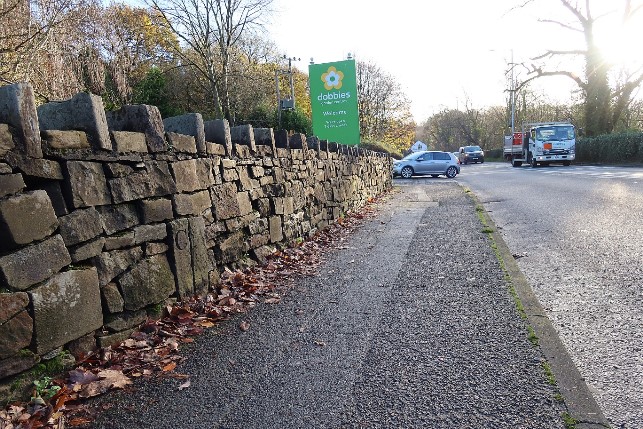
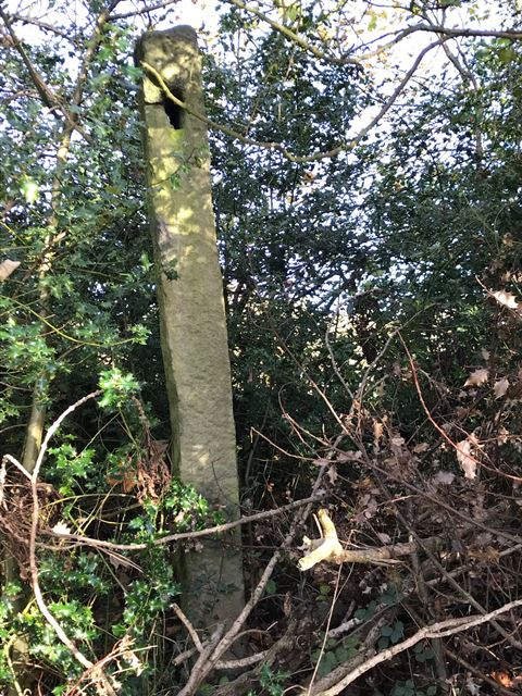 This stone post in the hedgerow at the junction of Ley Lane and Hollins Lane would once have housed finger posts indicating the direction of Mill Brow and Marple Bridge. It is no longer vertical but then neither would you be if you had stood in the same place for two or three hundred years.
A shorter, stubbier version which carried out the same role can be seen on Mellor Moor at the junction of Primrose Lane with Black Lane. The wide angle photograph shows Black Lane with a road surface that is probably similar to that of 200 years ago.
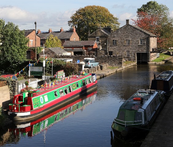
When travelling from place to place it was useful not only to know the direction of your destination but also the distance. This is where milestones played their part, marking distances in both directions. The best example locally is the Peak Forest Canal. When the canal was constructed markers were placed every half mile along the fifteen mile length. These were partly to show the distance from the start of the canal at Portland Basin in Ashton but mainly to calculate the fee to be paid by each boat depending on the distance travelled and the nature of the cargo. Only about half of these milestones remain but we are lucky in having three of them along the flight of locks; milestones at Lock One and Lock Fifteen and a half-milestone at Lock Eight. The markers at Locks One and Eight are weatherworn and no inscription is visible but the marker at Lock Fifteen is clearly inscribed which leads to the suspicion that it is a modern replacement. However, modern or not, it is at least eighty years old as the destination name has been deleted - a precaution taken at the start of the Second World War in case a German invasion took place. All the milestones are the same shape with a distinctive curved top but the half-milestones are about 20% smaller than the full milestones.
 Milestone at Lock One
There are similarly shaped milestones along the Macclesfield Canal, starting at Marple Wharf, opposite the warehouse. However, these are all modern substitutes, installed by the Friends of the Macclesfield Canal.
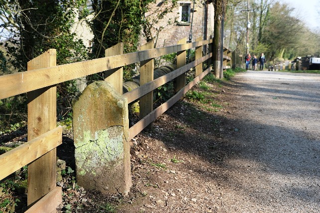
Old milestones can also be found alongside some of the roads in our area. The oldest we know are in Poynton with one near the centre of Poynton, to the south of the church and another, one mile north, between Poynton Pool and Brookside Garden Centre. The road today is the A523 but it was originally a turnpike, laid out by Blind Jack of Knaresborough for the Warren family. Both these two milestones and another, one mile further south were original though not in their original location but a few years ago the milestone near the church was vandalised beyond repair and a modern replica was made.
A6 and Blind Jack's - click images for alternate views
 Junct. of Middlewood Road with the A6
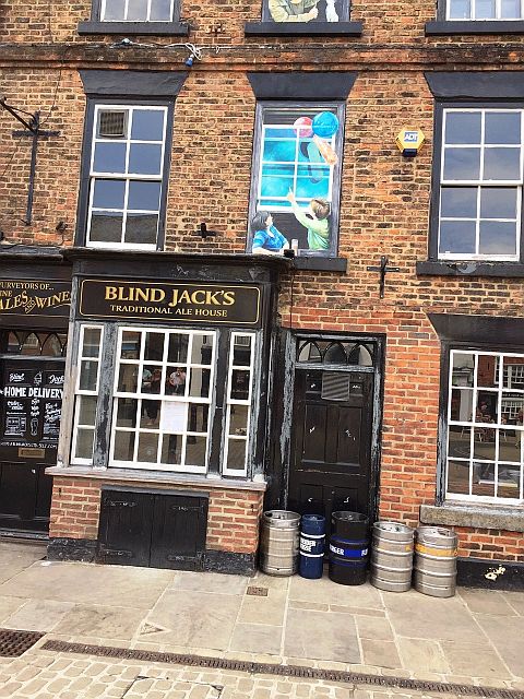 Blind Jack passes time with friend
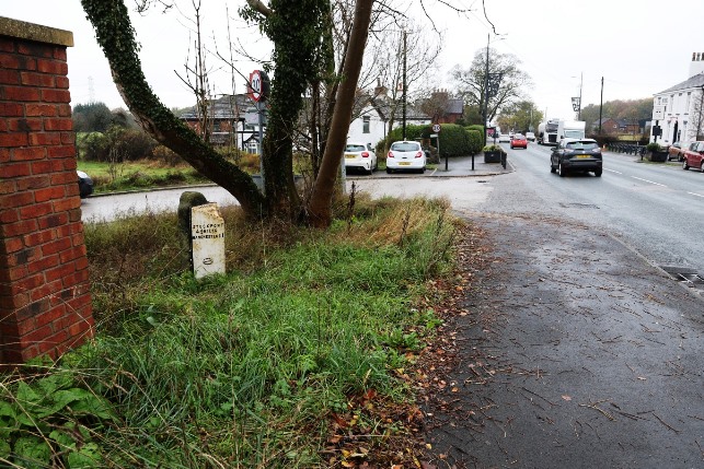
In High Lane there is a slightly more modern milestone at the junction of Middlewood Road with the A6. This dates to the late-Victorian period when County Councils took on the responsibility for road maintenance and directions under the Local Government Act of 1888. This marker is a triangular metal construction, dated 1898, but intriguingly it is supported by a stone slab in the distinctive style of the Peak Forest Canal milestones. Whether this was a deliberate copy or a repurposing of one of the original canal markers, we shall never know.
There are also several examples of markers, similar in size to milestones but serving a different purpose. These are boundary markers which indicate the boundary between two authorities. Sometimes this simply shows the border between two authorities but it can indicate a more specific responsibility. There is a boundary marker in Marple Bridge against the wall of the bridge over Mill Brook. This marks the border between Mellor and Ludworth townships. Similarly there is a rather more elaborate marker on Norbury Hollow Road where it crosses over Norbury Brook. As can be seen in the photograph, this dates from 1857 when the railway was being constructed but the stone was retained when the bridge was strengthened in 1928.
Marple Bridge Boundary Stone- click the image to see a wider view
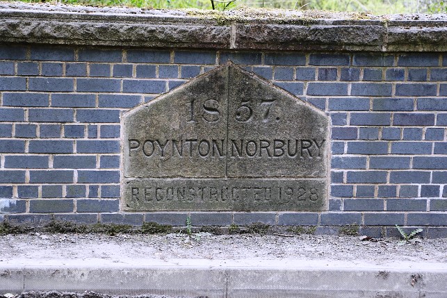
Norbury Hollow Road
These merely show where the boundary of one authority ended and another began but there are some markers which had financial implications. These are usually on the approach roads to bridges. Long before turnpikes came into being in the eighteenth century, county councils assumed responsibility for bridges on the main routes. At first there were very few but as trade increased the councils took responsibility for more bridges but they took pains to limit their financial obligation. They would usually guarantee to maintain the bridge itself and 300 feet of approach road on either side of the bridge. Beyond that point maintenance was the responsibility of the parish or the township or perhaps the turnpike trust. There are examples of this type of boundary marker on the approach to both Compstall Bridge over the Etherow and Otterspool Bridge over the Goyt though it is doubtful if either is in its original position. Dooley Lane in particular used to run much closer to the river. The Compstall marker is partly buried in the wall foundations but the Otterspool marker has a clearly inscribed ‘C’ for Cheshire on one side of the dividing line.
Maintenance Responsibility - click the images to see alternate views
x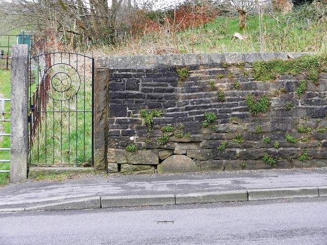
Near Compstall Bridge
On the approach to Otterspool Bridge
Another item of street furniture which was relatively common two hundred years ago is now almost never found in its original location. Stocks were invariably placed in very public locations in order to expose the miscreant to as much public shame as possible. The Marple stocks were originally on Church Lane, alongside the Ring o’ Bells public house, and on the route that most people took to church. They have now been consigned to the Memorial Park. Mellor too had its malefactors and the stocks can now be seen in St Thomas’ churchyard. But where were the Mellor stocks located originally? Mellor has no obvious village centre where the scoundrels could be displayed and shamed. It could be argued that the church was a centre of village life and the majority of the people living in Mellor would be likely to attend the church at least once a week. Perhaps the original site of the Mellor stocks was actually in the churchyard, close to where it is now.
However, we have recently come across another candidate for Mellor’s instant justice. Frank Pleszak was passing through the churchyard gate leading down to Knowle Farm when he noticed something unusual about the gate posts.
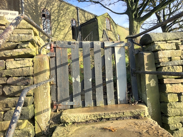
They were substantial stone piers, considerably out of proportion to the wicket gate they supported. Even more revealing, one of the posts had a closed groove channelled into one side. The other post was smooth-faced but it could have a similar channel on its hidden face. There is no way of proving this simply and easily but it does look suspiciously like the stone supports for a set of stocks. But if that is the case, where have they come from? Did Mellor need two sets of stocks to carry out instant justice? How long have they been there and what else could they be?
Another unusual example of street furniture is the row of concrete cylinders (below) used to stop cars driving into the canal at Marple Wharf.
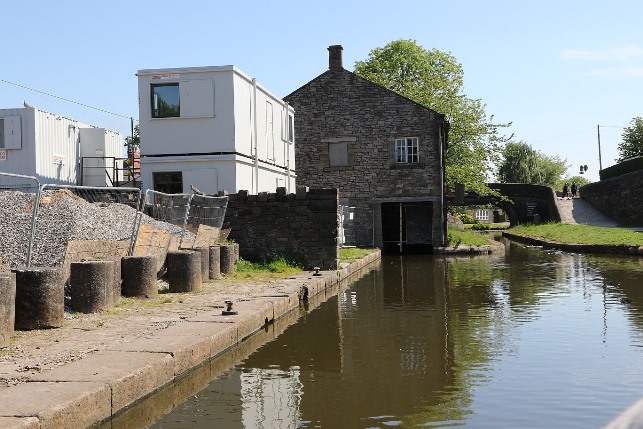
They are certainly an effective obstacle to prevent runaway cars entering the canal but their original purpose was even more dramatic. They were a wartime measure to block key roads in the event of an invasion. As a boy at All Saints’ School, Edmund Wilkinson remembers them stacked on the pavement opposite the Ring o’ Bells. Going home after school, the children would squeeze between them, though in those days Edmund believes they were much larger than they appear today. Fortunately they were never used for their intended purpose; to forestall an invading army marching along the Ridge Road from Disley. At the end of the war they were commandeered for the useful peacetime function they carry out today. Edmund also remembers a similar set of obstacles on Dooley Lane at the Dan Bank end. These were removed at the end of the war and taken to the council yard which was on Railway Road at Rose Hill at the time. They disappeared at the same time as the council yard was closed and there is no longer any trace of them. Except there could be a trace. When they were moved from Dooley Lane one of the cylinders rolled down into the valley of Marple Brook. It might well still be there if someone is prepared to look for it.
**STOP PRESS**
After sitting quietly beside the canal for over seventy-five years, performing the useful function of preventing cars driving into the water, these concrete barriers have now disappeared. We don’t know who is responsible but it would seem to be one of the organisations revamping the Wharf. If it is not too late, please could we have our bollards back. We have ideas as to what to do with them and how to use them so we hope that the people that have taken them away know what they are and will look after them until they are returned.
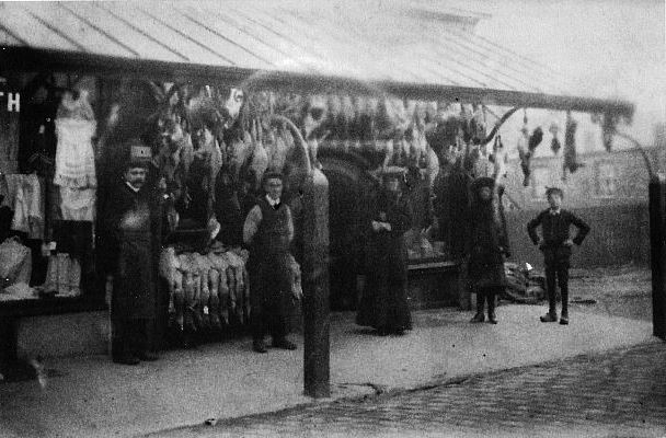 click the image to Jacksons Fish Shop in 1904, under the Market Street verandah
There are still a few examples of street furnishings that can be seen if you look carefully. At one time all the main streets in Marple were paved with setts but nowadays almost all of them have been buried under tarmac. A few can still be seen, peeping out from worn areas of road or in little used side roads that have not been adopted by the council. But who remembers that civilised piece of street furniture that kept the shoppers dry in Market Street? When the row of shops with living accommodation called Exchange Buildings was constructed in 1904 at the Church Lane end of Market Street, the developer seems to have had grand designs for his investment. Perhaps imagining a version of Southport-on-the-Goyt, he commissioned a verandah of cast iron and glass (above) to protect the ladies from the rain, (and hopefully encouraging them to patronise the shops which provided the facility.) This lasted for sixty years, only being dismantled in the 1960s, but regrettably none of the other landlords followed his example. Most of Market Street remained exposed and rain-swept. There is no sign of the support brackets on Market Street itself as the shops have expanded their signs and any remnants of the support brackets are hidden.
However, the verandah extended round the corner onto Church Lane and the fixing holes are still there, but covered up by a brick moulding commemorating the year 2000.
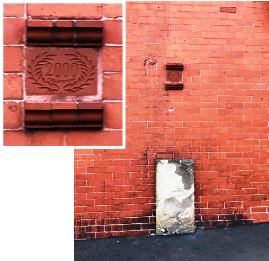
But wait! What is the stone slab underneath the fixing point? Yet more street furniture! But what is it? A milestone? A boundary marker? Or perhaps an old kerbstone moved out of the way when the road was last repaired. Answers on a postcard, please. Plus any other examples of old street furniture that we have missed.
Text : Neil Mullineux - December 2022
Photos: David Burridge
Editors note:
Herbert Spencer, a graphic designer, drove from central London to Heathrow in 1961, on the way he took photos of every road sign on his journey, publishing the result in his magazine Typogrphica. The photos showed how confusing signs were at the time - each one used different typefaces, symbols and colours. The number of cars on the road was increasing and it was obvious that Britain needed an understandable and easy to read system of road signs.
This huge project was given to graphic designer Jock Kinneir, along with his assistant Margaret Calvert. They had just finished the creation of signs for the country’s motorway system. By carefully coordinating lettering, colours, shapes and symbols, the pair created a system that has inspired modern road signs around the world. Pictures instead of words were used on many signs and the girl in the Children Crossing sign is based on an image of Margaret Calvert as a child.
Futher Reading & Viewing:
Historic England Blog - From Lamp Posts to Litter Bins: The Stories Behind England’s Street Furniture
Bailey Streetscene Company - The History of Street Furniture
Margaret Calvert and her impact
Margaret Calvert on her favourite road signs and working with Banksy (BBC video)
