Our Local Heritage
A fascinating collection of stories and articles covering the diverse local heritage of Marple and District.
The articles are presented in Blog format (in title order) or as an article listing (also in title order).
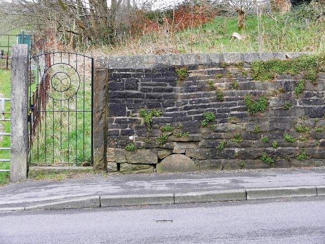
Though Marple may not have any street furniture that rivals the notoriety of a slightly nauseous but ingenious piece of Victorian engineering, the Farting lamp, on steep Carting Lane near the Savoy, London. Marple does possess, however, many examples of street furniture. Enough to start filling that I-Spy book that your aunt gave you at Christmas. Although many signs and markers have either disappeared or been superseded by newer versions, there are still many historic markers to find in our area, by those in the know.
But first you may well ask- What is meant by the phrase ‘Street furniture’? Wikipedia, as ever helpful, gives a litany of categories, "Street furniture is a collective term for objects and pieces of equipment installed along streets and roads for various purposes. It includes benches, traffic barriers, bollards, post boxes, etc “, whereas Historic England goes straight for a four category approach, (1) Beneficial Utility (2) Traffic Measures (3) Communication (4) Control Enforcement and Security.
This month’s Heritage article, then, will need you to keep your eyes peeled, as you venture out into the short lived light of a winter’s day. Wrapped up and dreaming of 40c in August 2023, as you seek-out milestones, direction posts, boundary markers.
MC
- Category: Our Local Heritage
- Hits: 1084
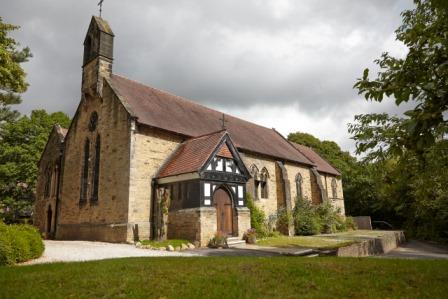
Have you found Marple’s Hidden Gem yet? Maybe you have walked past it, or by it many times without realising it?
The gem is St. Martin’s Church, Low Marple on Brabyns Brow, next to Marple Station. This church, quite modest from the outside has many wonderful windows and artefacts designed and made by eminent artists and architects.
- Category: Our Local Heritage
- Hits: 6018
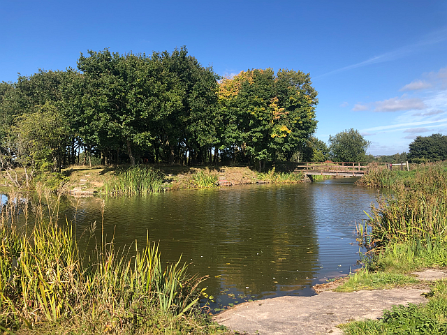 Broadoak Moated House
On the edge of Stockport Golf Club, next to Broadoak Farm, is a squarish platform of land, surrounded by a moat on all sides. Although it is private property and well away from any roads it is adjacent to a public footpath running from Torkington Road to the Middlewood Way. It is quite a sizeable feature in the landscape but what exactly is it?
- Category: Our Local Heritage
- Hits: 3557
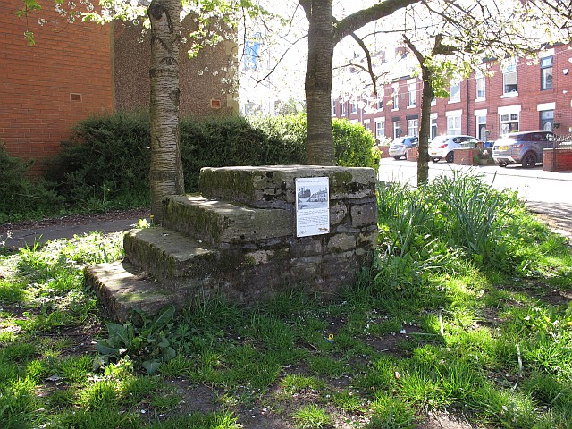 Have you ever thought about how our ancestors moved around Marple and Mellor in the days before motor cars and public transport? Of course the rich would be alright. The Isherwoods or the Hudsons had their own coaches and, slightly down the social scale, the wealthy businessmen returning by train from Manchester each day would take a horse-drawn cab.
- Category: Our Local Heritage
- Hits: 3719
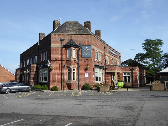 The ‘mystery picture’ in the MLHS August newsletter was an aerial view of the Fiveways Pub on the corner of the A523 Macclesfield Road and Dean Lane in the Norbury area of Hazel Grove. Picture 1 The Fiveways The pub was built in the late 1930s, the architectural style corroborates that period. However, Norbury goes back much further. From Medieval times scattered groups of settlers survived by subsistence farming. People would have been travelling through the area from Roman Times as the Roma road from London to Carlisle, forms part of the A6. It is easy to imagine businesses setting up along the way to attend to the needs of travellers: inns, blacksmiths and a variety of shops.
- Category: Our Local Heritage
- Hits: 4410
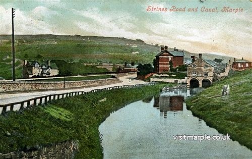 There are three main elements in the project for Revealing Oldknow’s Legacy - Marple Aqueduct, Mellor Mill and the Lime Kilns. The aqueduct is well-known and has just been repaired; excavations at Mellor Mill are well under way; but what about the Lime Kilns? Do they deserve more prominence and is anything happening to make them more accessible? Who better than the County Archaeologist for Greater Manchester, Norman Redhead to explain ...
Photo: The Strines Road arm of the canal, now filled in, which used to run from Possett Bridge to the Lime Kilns.
- Category: Our Local Heritage
- Hits: 2145
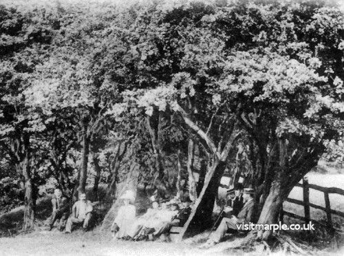 Oldknow’s Seat is locally the stuff of legend, but it’s not a myth - it does still exist. Many of us will have heard of it, it is marked on old maps and over the years lots of locals have had their photo taken sat on it. Those that were children in the fifties and sixties remember it as the ‘Giants Chair’. Though it is now not easy to locate, some recent ‘intrepid explorers’ have managed to find their way to it.
It’s located on private land with no general public access, less than a kilometre to the south east of Mellor Mill on the side of the Goyt valley just below Mellor & Townscliffe Golf Club’s most westerly hole, the 14th which is appropriately named Oldknow’s Seat.
- Category: Our Local Heritage
- Hits: 3599
 I often think it’s comical – Fal, lal, la!
How Nature always does contrive – Fal, lal, la!
That every boy and every gal
That’s born into the world alive
Is either a little Liberal
Or else a little Conservative!
Fal, lal, la!
So sang Private Willis at the opening of Iolanthe at the Savoy Theatre in 1882. The comic opera satirises many aspects of British government, law and society but, like most satires, it was based on actuality. Parliament had a strong two party system with Liberals and Conservatives and politics was becoming much more part of everyday life.
- Category: Our Local Heritage
- Hits: 1503
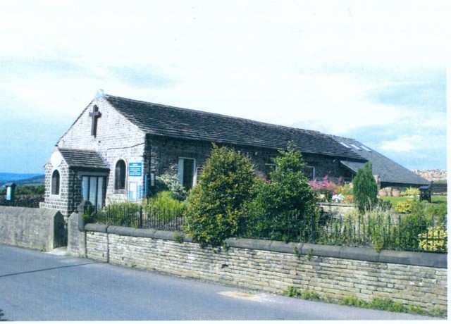
After the restoration of the monarchy in 1660, attempts to impose uniformity of religious practices met with opposition and led to break away groups of ‘non-conformists’. Their ideas of independence and self-help appealed to workers and industrialists alike and grew in popularity as the Industrial Revolution gained pace. Methodism seems to have had the greatest presence in the Marple/Mellor area, possibly because John Wesley had visited and preached in Mellor several times in the early days of the movement in the mid 1700s. It was by no means just one religious idea, but had many factions; today it is a little difficult to fathom out the differences which were so important at the time.
- Category: Our Local Heritage
- Hits: 1624
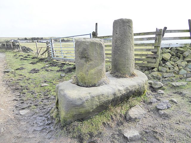
The rough moorland of the Pennine foothills is criss-crossed by tracks which were the main roads of early times when most people had to travel everywhere on foot, or if they were lucky, on horseback. These have become our public bridleways and let us walk and ride freely in the countryside, which has been doubly appreciated during these last few months. Nowadays junctions on these tracks are indicated by official signposts, but long ago most people couldn’t read so there had to be other kinds of markers.
- Category: Our Local Heritage
- Hits: 2582
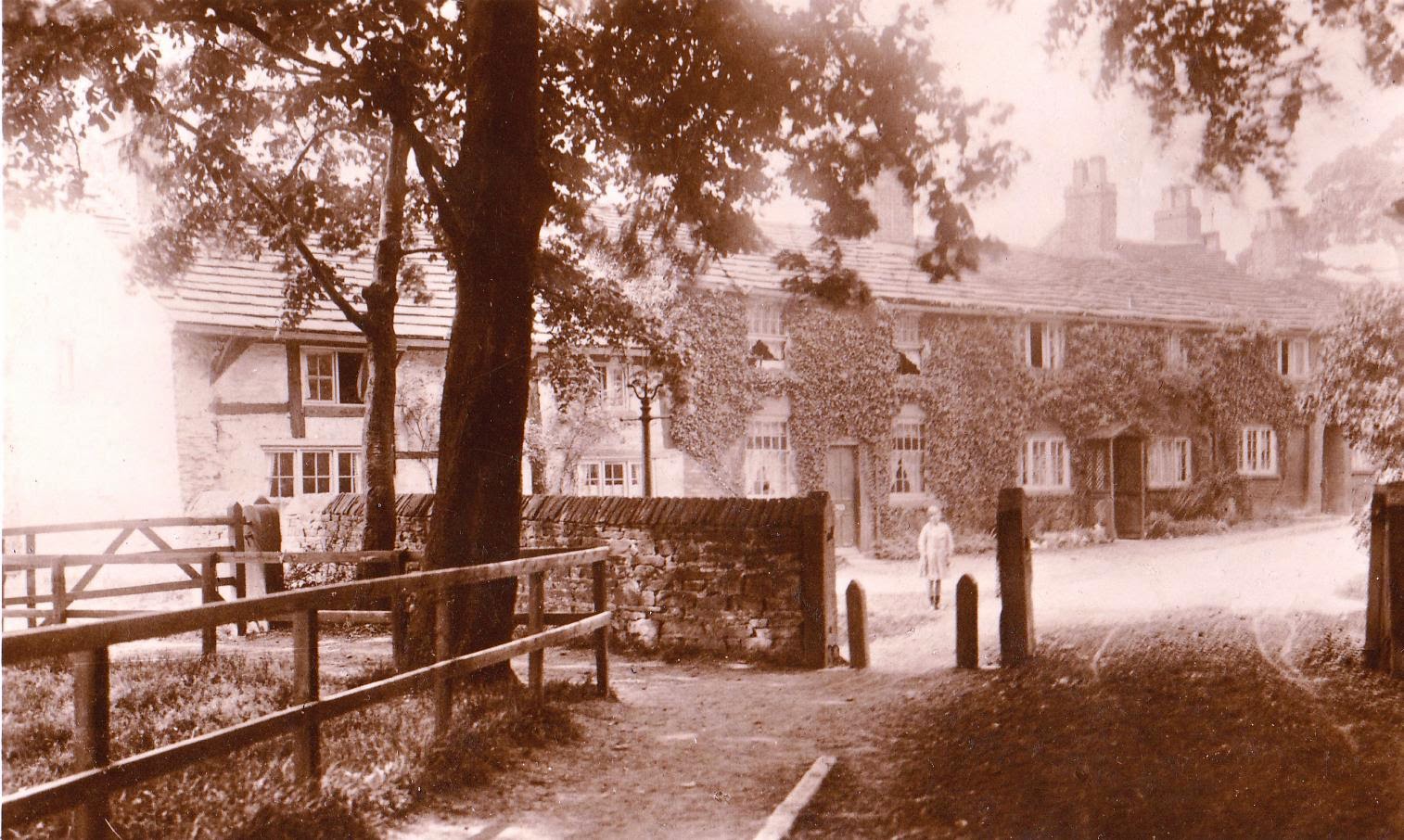 The clue is in the name - Fold. It means an enclosure from waste land or moor land, either for people or for animals. It still survives in the word ‘sheepfold’ but originally it had a much wider application.
Next time you are going through Romiley, take a small detour and visit these two Folds - you won’t regret it.
- Category: Our Local Heritage
- Hits: 6111
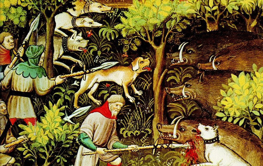
It can be hard to imagine that Mellor was once in the midst of a forest. Or perhaps not. It wasn’t ‘in the midst’ but right on the edge. And it wasn’t much of a forest anyway, even though it was called the Royal Forest of the High Peak. Yes, there were more trees than there are today but not many more.
At its height in the thirteenth century, an estimated one-fourth of the land area of England and its riches came under the special jurisdiction of forest law.
- Category: Our Local Heritage
- Hits: 1155
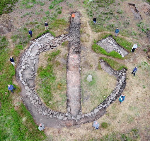 ‘Heritage’ is a broad term and can cover a wide range of dates. Recent articles about Our Local Heritage have ranged from fifteenth century cruck barns to twentieth century swimming baths, but most of them centre around the period of the Industrial Revolution when Marple and Mellor began to change from rural to urban communities. However, our heritage goes back much further; much, much further. The first indications of human activity in this area date back to the late Mesolithic Period.
Stockport has six Scheduled Monuments and five of those are in Marple and Mellor - two prehistoric, one medieval and two from the industrial revolution. With the discoveries at Shaw Cairn this number could (and perhaps should) be raised to six.
- Category: Our Local Heritage
- Hits: 2793

